NewsColony
‘Coldest start to May’ as icy conditions carry through to weekend
As icy winds continue to send a chill across Australia’s east coast, record-breaking temperatures and damaging conditions are expected to continue through to the weekend.
Victoria has recorded its coldest and wettest start to May in more than five decades, with severe weather sweeping a cold snap across Australia this weekend.
The Bureau of Meteorology said an icy chill swept the Victorian Alps with rain and hail forecast.

Today’s max of just 12 degrees for the state means it will be the coldest May in more than 50 years, with temperatures hitting just 12.2 degrees back in 1962.
Rain and wind will likely lash the city’s east today with strong winds expected to hit the Mornington Peninsula and bayside areas.
The alpine regions are expected to have more snow and blizzard conditions after waking to temperatures of -4 degrees this morning.
South Australia
A severe weather warning is also in place for South Australia’s southeast with damaging winds expected to last through the weekend.
Damaging winds are expected to batter the state’s east today with gusts of more than 90km/h predicted.
The severe weather warning is in place for regions between Clare, in the Mid North, through to Kangaroo Island.
Strong winds began developing yesterday evening and squall-like showers are likely to hit areas near the Mount Lofty Ranges, Upper and Lower South East and Riverland districts.

Queensland
Yesterday in outback Queensland, Thargomindah broke its 1989 record for the coldest April day when temperatures reached just 18.5 degrees.
This morning, Applethorpe in the Southern Downs dropped to just 5.1 degrees and temperatures in Brisbane and Ipswich are forecast to reach just 25 degrees today – five degrees cooler than yesterday’s temperatures for those areas.
“It’s the first cold morning really we’ve had this year,” Granite Belt Wine and Tourism president Martin Cooper told Weatherzone.
“I knew it was cold because the dogs just looked at me when I said: ‘Come on, get out’ they just went back in front of the wood fire.”
Skies should remain clear in the state, but cold winds will continue in the southeast with temperatures in Maroochydore expected to drop as low as six degrees tomorrow.

New South Wales
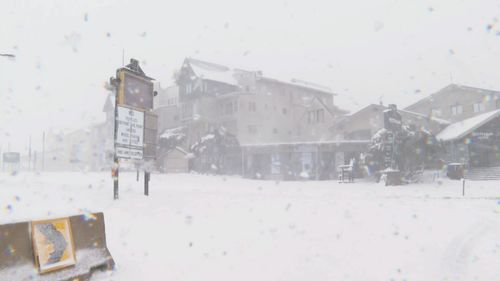
The New South Wales Perisher region also saw a wild and wintery start to the month with heavy snowfall, strong winds and icy temperatures blasting the resort overnight.
Fifteen centimetres of snow fell overnight, and it is still coming down with more predicted over the weekend.
Blizzard conditions are likely to last through until at least Sunday, however some snowy regions will experience drier conditions by Monday.
While the sun is out in Sydney, the city will only see temperature tops of 17 degrees with possible showers in the afternoon.

The winter-like weather is due to a pool of cold air surging out from the Southern Ocean, causing temperatures to plummet according to Weatherzone.
Source: 9News
The post ‘Coldest start to May’ as icy conditions carry through to weekend appeared first on NewsColony.
NewsColony
from WordPress https://ift.tt/2KR24s5
Comments
Post a Comment